
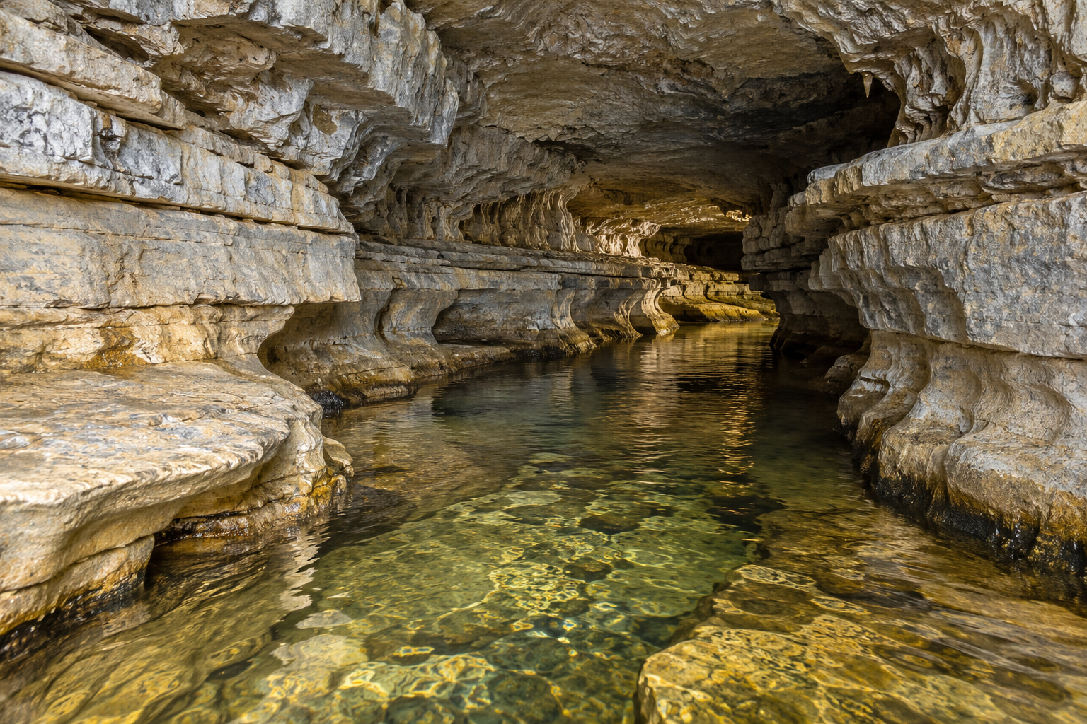
The limestone is solid, the rain is only mildly acidic, and the opening may begin as a crack. How does that combination become a cavern? The answer is a relationship between chemistry and pathways: water must be able to react with rock, move through it, and carry dissolved material away.
A limestone cave is also part of a larger landscape. The spring at the valley edge, the stream that disappears into a depression, and the dry passage above an underground river may preserve different parts of its history. Following the water makes that history easier to understand.
A: No. Weakly acidic water can dissolve carbonate over time when conditions support it.
A: They provide initial access routes through otherwise solid-looking rock.
A: No. Dissolution also develops underground routes through the rock.
A: No. Water sources, chemistry, structure, and geological history vary.
A: Yes. Older passages can become dry when drainage shifts.
A: They usually accumulate within an already existing cavity.
A: No. The cavity generally develops later than the host rock.
A: Not reliably; flow conditions require appropriate measurements and investigation.
A: Surface geology and water inputs help explain underground development and vulnerability.
A: Separate the removal of rock that creates space from deposits that later decorate it.
Begin with a route, not a room
Limestone contains carbonate minerals, commonly calcite. Water carrying dissolved carbon dioxide can form weak carbonic acid, allowing it to dissolve carbonate under suitable conditions. Soil processes often supply additional carbon dioxide before water reaches the rock. The result is not an instant hollowing of an entire hillside. Dissolution works where water can make contact and continue moving.
Fractures and boundaries between rock layers provide initial routes. A tiny opening may admit only limited flow. As a route enlarges, it can carry more water, creating opportunities for further enlargement. The surrounding rock structure helps determine whether passages branch, follow a bedding plane, or intersect along joints.
The chemistry is a balance, not an endless appetite
Water does not dissolve unlimited limestone merely because it once contained carbon dioxide. Its dissolved mineral content, temperature, and carbon dioxide conditions influence what it can dissolve. Water that has approached equilibrium with the surrounding rock behaves differently from newly arriving water. Mixing waters with different chemistry can also affect dissolution.
This is why a simple “acid eats rock” picture is incomplete. A cave system needs a continuing supply and movement of water, and its development responds to changes in that supply. Geological explanations distinguish these chemical conditions from the mechanical action of sediment carried by a stream. Both can influence a passage, but they are not interchangeable processes.
Read the cave together with the hillside
Karst is the wider landscape associated with dissolution of soluble rock. Its features can include closed depressions, sinking streams, caves, and springs. A surface stream may enter an opening and continue underground; elsewhere, water may infiltrate through many smaller routes. The outlet at a spring records where water returns to daylight, not necessarily a simple straight route back to one entrance.
Consider an imagined limestone valley with a stream disappearing near its head and a spring at its lower end. That arrangement suggests a question about connection. It does not prove the connection or establish how quickly water travels. Geological mapping, water observations, and appropriate investigations are needed to move from a plausible explanation to evidence.
| Observation | Useful interpretation | What remains uncertain |
|---|---|---|
| A stream disappears into rock | Surface water is entering underground drainage | Its complete route and eventual outlets |
| A dry passage sits above a stream | Drainage may have occupied another level | The timing and sequence of change |
| A mineral curtain coats a wall | Deposition occurred after a cavity existed | The age and duration of growth |
| A spring flows below a ridge | Groundwater is emerging at that location | The full extent of its catchment |
Why the passage is not always the shape of a stream
Water can occupy an opening completely or flow through an air-filled passage. Those circumstances expose different parts of the rock to flowing water. A passage enlarged while filled with water may preserve rounded forms, while a later stream can cut a narrower channel into its floor. Real caves often contain overlapping histories rather than one textbook shape.
Changes outside the cave matter too. As a river valley deepens or the position of the water table changes, drainage may shift to a lower route. An older passage can remain above active water, preserving sediment and shapes from its earlier use. A cave with several levels should therefore be read as a sequence of changing conditions.
Making the cavity and decorating it are different chapters
A stalactite is not a remnant left behind while all the surrounding limestone dissolved away. It is a secondary mineral deposit. When suitable mineral-bearing water enters an air-filled cave and loses carbon dioxide, calcite can be deposited. Repeated deposition can build hanging formations, rising floor deposits, thin curtains, and coatings called flowstone.
The important distinction is direction: dissolution removes material; deposition adds it. A cave may contain evidence of both, at different times and in different places. A broad passage can be relatively undecorated, while a smaller chamber receiving favorable seepage develops abundant formations. Decoration alone does not tell you how large, old, or geologically significant the cave is.
Keep three ages separate
- The age of the host rock: when the limestone itself formed.
- The development of the cavity: when particular passages were enlarged and modified.
- The age of a deposit: when a formation or sediment layer accumulated inside.
These can be very different. Describing a cave as the same age as its limestone skips the later history that created the opening. Likewise, dating one mineral deposit does not automatically date every passage around it. A useful explanation identifies which material or event the age actually describes.
A landscape still connected to the surface
Underground does not mean isolated. Water and material entering a karst system can connect surface activities with springs and cave habitats. Clear water is not proof of purity, and the absence of a visible surface channel does not mean that water has stopped moving through a landscape.
When you next study a limestone cave, begin outside: find the rock layers, the valleys, and the known drainage features. Inside, distinguish the passage walls from later deposits and look for evidence of changing water routes. The chamber then becomes more than a hollow in stone. It becomes a surviving part of a landscape’s movement of water through time.
Related Articles
What Makes a Grotto? Natural Caverns, Garden Retreats, and Pool Caves
Explore the differences between natural grottos, garden retreats, and pool caves—and learn to describe the experience you want.
Natural Stone, Sculpted Concrete, or GFRC: Comparing Grotto Rockwork
Compare natural stone, sculpted concrete, and GFRC grotto rockwork through appearance, support, joints, fabrication, and repair.
A Grotto Inspection Walkthrough: Changes to Notice and Record
Build a useful grotto inspection record with repeatable photographs, clear observations, water-pattern notes, and follow-up.