
Sea Caves & Coastal Grottos

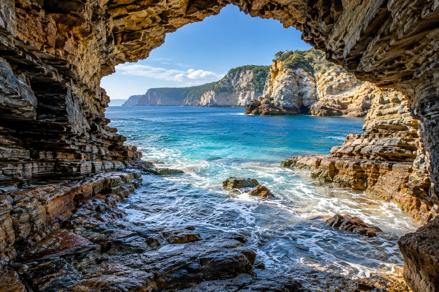
Illustration of waves entering a layered coastal sea cave

At the foot of a cliff, a dark opening turns the coastline into an interior. Waves enter, light rebounds from the water, and the rock records weaknesses that the sea has gradually enlarged. Sea caves offer a different visual language from mineral-decorated limestone caverns: their drama often comes from fractures, worn walls, moving water, and the bright contrast of an ocean entrance. This collection explores how coastal grottos relate to the cliffs around them and why their shape cannot be understood without the shoreline setting. Discover wave-cut passages, arch-like openings, changing water levels, and the textures that make a marine cave recognizable. Photographers and designers can study the relationship between reflected light and rough stone, while geology readers can investigate the processes behind those forms. Access conditions deserve separate attention from appearance; a calm photograph captures only one moment in a changing coastal environment. Approach these places through reliable site information and geological context, then use their forms as inspiration for spaces that evoke the coast without confusing a constructed retreat with an active shoreline.

Wave action: Repeated water movement enlarges weaknesses in coastal rock.
Rock structure: Joints and faults can influence cave alignment.
Shoreline setting: Exposure helps explain differences between neighboring openings.
Littoral cave: Another term for a cave associated with a shoreline.
Abrasion: Moving sediment can contribute to rock wear.
Entrance geometry: The opening controls views and incoming light.
Water level: Tides and other conditions change the visible interior.
Rock resistance: Different layers may erode at different rates.
Coastal evolution: A cave belongs to a changing cliff system.
Location records: Geological context improves interpretation of photographs.
Marine origin: A coastal location alone does not prove wave-cut formation.
Freshwater shores: Wave-formed caves also occur beside lakes.
Multiple openings: A single chamber may connect to more than one entrance.
Daylight contrast: Bright water can leave wall details difficult to see.
Sediment cover: Sand or cobbles can conceal the underlying floor.
Changing exposure: The same opening looks different under different sea conditions.
Fracture clues: Straight passage segments may follow preexisting weaknesses.
Mineral difference: Coastal caves need not display limestone-style decorations.
Scale ambiguity: An entrance photograph may lack a reliable size reference.
Ongoing change: Rockfall and erosion can alter familiar coastal features.
Geological maps: Identify rock units along the relevant coastline.
Official access notices: Check current site restrictions before planning a visit.
Tide information: Use authoritative local predictions alongside other coastal conditions.
Telephoto lens: Study an opening from an established viewpoint.
Polarizing filter: Compare its effect on reflected water without assuming it improves every image.
Notebook: Record viewpoint and conditions with each observation.
Coastal photographs: Compare the same feature at documented dates.
Topographic mapping: Relate cliff height and shoreline orientation.
Image catalog: Separate natural sea caves from constructed coastal-inspired scenes.
Local interpretation: Park and geological resources explain named coastal features.
Structural guidance: Erosion often exploits existing rock discontinuities.
View framing: A narrow opening can exaggerate perceived depth.
Light bounce: Water can illuminate an otherwise shaded ceiling.
Surface histories: Smooth patches and broken edges may record different processes.
Shore platforms: Surrounding rock surfaces add context beyond the cave mouth.
Linked features: Caves, arches, and isolated rock forms can belong to coastal erosion histories.
Photographic bias: Attractive images often omit the conditions controlling access.
Design translation: Broad fractures may evoke a coast more convincingly than stalactites.
Sound variation: Water impacts and enclosure shape influence the acoustic impression.
Temporal comparison: Repeated documented views reveal more than an isolated image.
Blue interiors: Reflected water can tint shaded rock.
Lake grottos: Ocean saltwater is not essential to wave-cut cave formation.
Hidden branches: A broad entrance can conceal side recesses.
Natural windows: Smaller openings may illuminate a chamber unexpectedly.
Pebble floors: Rounded stones reveal a different texture from cave sediment banks.
Tilted layers: Geological bedding can create striking diagonal ceilings.
Echoing entrances: An open mouth still produces a strong enclosed sound.
Foam lines: Temporary water patterns emphasize rock contours.
Silhouette studies: Entrance outlines remain recognizable when interior detail disappears.
Changing colors: Wet rock can look markedly different from nearby dry surfaces.
Q: Are all sea caves limestone caves?
A: No. Wave erosion can form caves in several rock types.
Q: Can lakes have sea-cave-like features?
A: Yes. Wave-cut shoreline caves also occur along lakes.
Q: Does a calm entrance mean conditions will stay calm?
A: No. A single observation cannot establish later coastal conditions.
Q: Why do passages follow straight lines?
A: Existing fractures may guide erosion.
Q: Are arches and caves the same feature?
A: No. Their openings and geometry differ, although coastal histories can connect them.
Q: Can a photo establish safe access?
A: No. Site-specific guidance and current conditions are essential.
Q: Why does the water look luminous?
A: Light reflected through and from water can brighten a shaded interior.
Q: Should coastal-inspired rockwork include stalactites?
A: Only where the intended geological story supports them.
Q: What should a reference photograph record?
A: Location, viewpoint, date, and available condition information improve its usefulness.
Q: Where is a good starting point for research?
A: A land manager's interpretation and regional geological mapping provide context.