
Limestone Caves & Karst

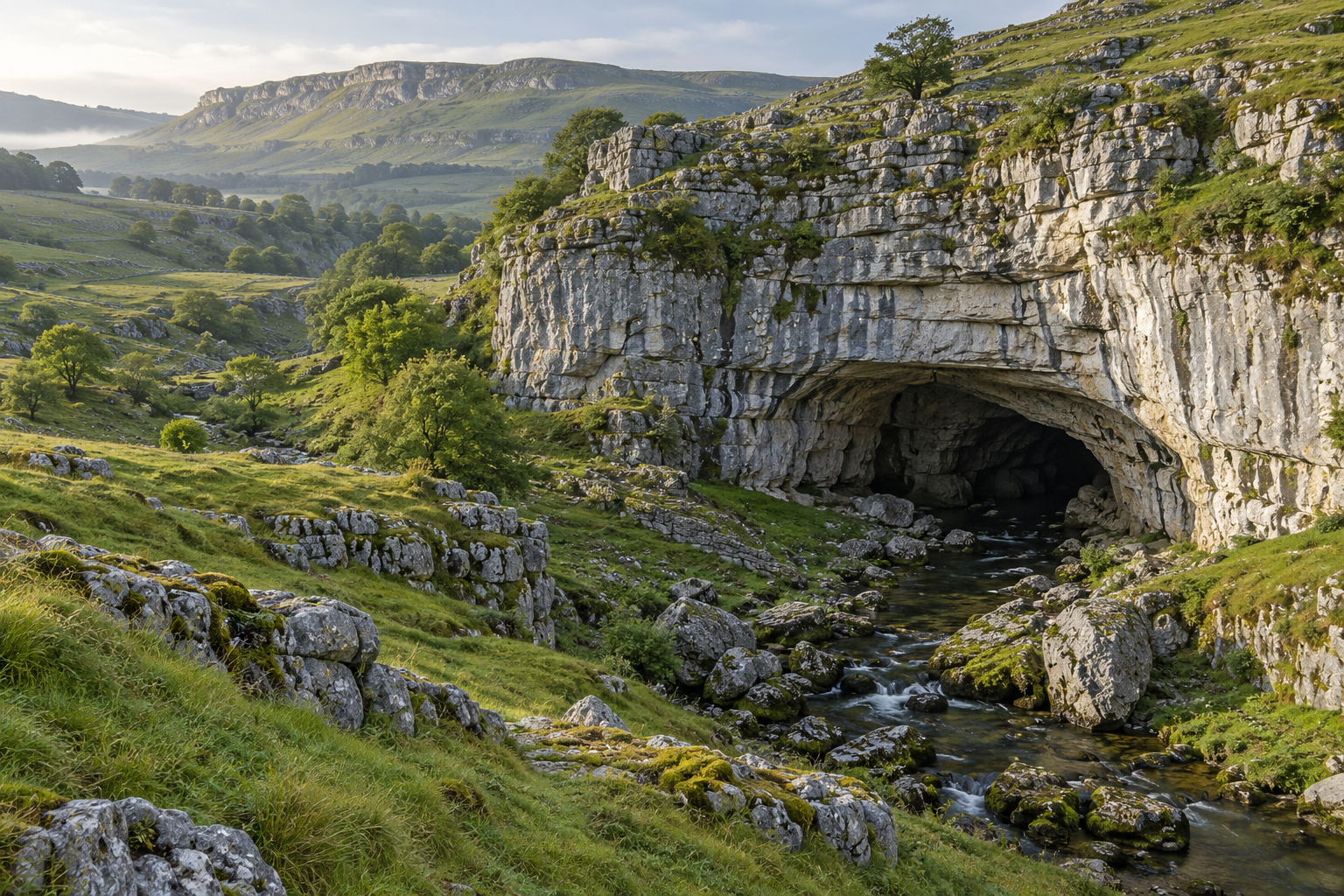
Illustration of a limestone cave entrance in a green karst landscape

A stream vanishes into a hollow, yet a spring runs steadily beyond the next ridge. In limestone country, those two observations may belong to the same hidden drainage network. Karst is the landscape that develops as water dissolves soluble rock, opening routes that can connect the surface with underground passages. This collection follows that relationship rather than treating caves as isolated rooms. Explore how fractures and bedding influence passage shapes, why sinkholes occupy particular parts of a landscape, and what cave sediments reveal about former streams. Compare groundwater routes with the valleys and hills visible above them. Limestone caves also contain a second story: mineral deposits that accumulate after a cavity already exists, sometimes preserving evidence of changing conditions. Readers interested in geology, mapping, landscape interpretation, or convincing grotto design will find vocabulary for recognizing these features and understanding their differences. The emphasis is on observing patterns, reading reliable records, and keeping uncertainty visible. A cave photograph may be striking; understanding the surrounding karst explains why that particular space could develop in that place underground.

Soluble foundations: Limestone contains carbonate minerals that can dissolve in water under suitable chemical conditions.
Carbon dioxide: Water interacting with carbon dioxide can become weakly acidic before moving into rock.
Initial pathways: Joints and bedding openings provide routes that may gradually widen through dissolution.
Connected drainage: A karst catchment may move water through both small openings and larger conduits.
Sinkholes: Surface depressions can collect drainage and provide clues to processes beneath the ground.
Sinking streams: A surface watercourse can enter underground openings instead of continuing down an open valley.
Resurgence: A spring marks a location where underground water emerges at the surface.
Passage development: Changing water levels and flow conditions can leave several generations of cave passages.
Mineral deposition: Cave decoration forms when dissolved material is deposited rather than removed.
Landscape context: Interpreting a cave requires attention to the rock and drainage beyond its entrance.
Karst is a landscape term: It describes more than a single cavern or sinkhole.
Limestone is not the only host: Other soluble rocks can also develop karst features.
Water chemistry varies: The ability of water to dissolve or deposit mineral changes with its conditions.
Openings need not be accessible: Much underground drainage occurs through spaces too small for people.
Streams carry solids too: Sediment movement can accompany chemical removal of rock.
Dry passages have histories: A former stream route may remain after water takes a lower path.
Springs integrate catchments: The water at one outlet may have traveled through a wider area than its immediate surroundings suggest.
Decorations are younger than their cavity: A stalactite needs an existing space in which to grow.
Surface and underground divides differ: Visible ridges do not always describe the complete groundwater boundary.
Maps have limits: Surveyed passages represent documented space, not every possible underground connection.
Geological maps: Examine limestone units, contacts, and mapped faults before interpreting a karst landscape.
Topographic maps: Contours help locate closed depressions, valleys, and relationships between springs and surrounding hills.
Published cave surveys: Use plans with stated scale, orientation, and survey context to understand passage geometry.
Field notebook: Keep location, date, weather, and observation separate from your interpretation of a feature.
Camera with manual controls: Consistent exposures make surface textures easier to compare without exaggerating colors.
Scale references: An authorized, non-contact scale placed in a permitted setting helps communicate feature size.
Digital elevation viewers: Inspect the surface landscape while remembering that elevation models do not reveal hidden passages directly.
Regional water records: Spring discharge and groundwater reports can add context that a single visit cannot provide.
Reference publications: Geological surveys and land managers offer location-specific explanations and access information.
Image organization tools: Tag photographs by feature, locality, and source so visual references remain traceable.
Conduit feedback: Once an opening carries more water, continued flow can help enlarge the route further.
Multiple controls: Rock structure, chemistry, water supply, and changing base level all influence cave development.
Passage cross-sections: Rounded and incised shapes can reflect different histories of water occupying a passage.
Abandoned levels: Higher dry routes can preserve evidence of earlier drainage arrangements.
Sediment interruptions: Deposits may partly fill an older passage and later be removed again.
Spring complexity: An outlet does not by itself reveal every source or travel path feeding it.
Surface vulnerability: Rapid connections can make activities above ground relevant to underground water quality.
Formation overprinting: Mineral deposits may obscure older wall textures and sediment relationships.
Dating questions: The age of a deposit, a rock unit, and a cave passage are different quantities.
Design translation: Believable limestone-inspired rockwork benefits from consistent bedding and water-shaped forms rather than random bumps.
Hidden drainage: A valley can lose its stream while water continues moving below ground.
Stone curtains: Some mineral draperies are thin enough for light to reveal variations in their thickness.
Ceiling tubes: Slender soda-straw formations provide a striking contrast to massive cave columns.
Joined formations: A stalactite and stalagmite can eventually meet to form a column.
Surface echoes: A chain of depressions may hint at geological patterns that continue underground.
Mineral recycling: Carbonate can be dissolved in one setting and deposited elsewhere in the same broader system.
Changing routes: The passage visible today may no longer carry the water that originally enlarged it.
Small clues: A sediment line can mark a former water condition without resembling a dramatic cave feature.
Unexpected boundaries: Underground drainage can complicate assumptions based only on the direction of surface slopes.
Recorded landscapes: Old surveys and photographs can document changes that are difficult to recognize during one visit.
Q: Does every limestone outcrop contain a cave?
A: No. Suitable rock alone does not establish the water pathways and history needed for a particular cave.
Q: Can I trace a spring back to one visible sinkhole?
A: A connection needs evidence; nearby features are not automatically linked.
Q: Why does weakly acidic water matter?
A: Over time, suitable water chemistry allows carbonate rock to dissolve along existing pathways.
Q: Are sinkholes always caused by a collapsed cavern?
A: No. Karst depressions can develop through different processes, including gradual dissolution and subsidence.
Q: Is a stalagmite the same as a stalactite?
A: A stalagmite grows upward from the floor; a stalactite hangs from above.
Q: Does clear spring water prove it is safe to drink?
A: No. Appearance does not establish drinking-water quality.
Q: Can a map show all groundwater routes?
A: No. Maps and investigations describe available evidence and may leave connections unresolved.
Q: Why might a cave have several levels?
A: Drainage conditions can change, leaving older passages above newer active routes.
Q: Can artificial rock reproduce karst geology?
A: It can interpret its visible forms, but constructed rockwork does not reproduce the geological system.
Q: Where should a beginner start?
A: A regional geological overview and an interpreted, managed cave visit provide useful context.
Latest Limestone Caves & Karst Articles