
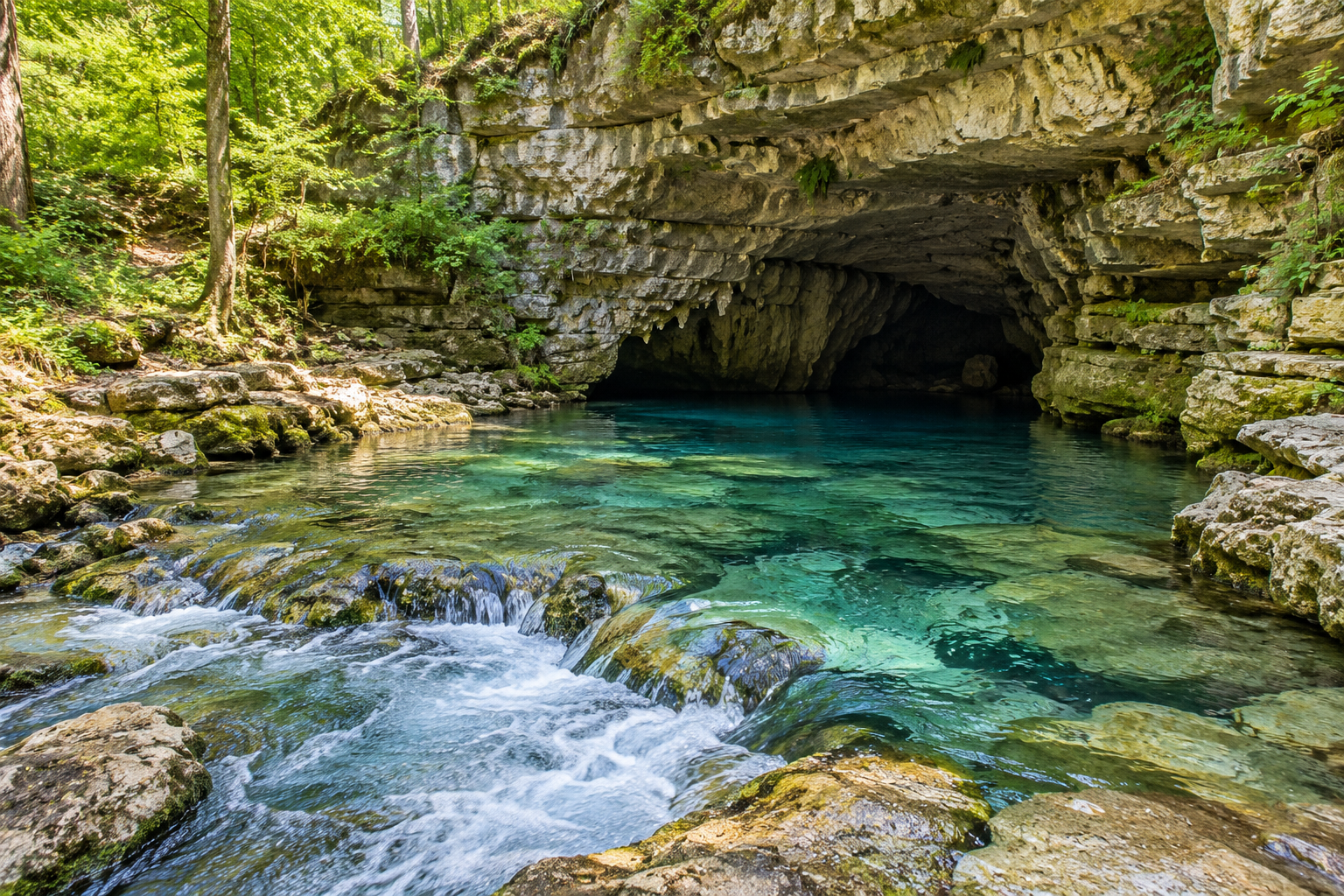
Underground Rivers & Springs

Illustration of a clear spring emerging from a limestone cave

A spring is an arrival point, but the route behind it may extend far beyond the visible opening. Water can travel through fractures, small pores, and larger cave passages before returning to daylight. Underground Rivers & Springs follows that hidden movement and the clues it leaves above and below ground. Explore sinking streams, flowing cave channels, spring pools, sediment traces, and the relationships between rainfall and underground drainage. The collection distinguishes what can be observed from what requires investigation: two nearby water features are not automatically connected, and clear water does not reveal its history. Readers interested in geology and landscapes can examine the wider catchment, while grotto designers can study the visual character of emerging water without treating a recirculating feature as a natural spring. Flow, sound, clarity, and seasonal variation all contribute to the identity of these places. Looking at an outlet becomes more rewarding when you also consider the rock around it, the land above it, and the evidence needed to understand where that water has been before it reaches your view.

Groundwater: Water occupies openings beneath the ground surface.
Conduit: A concentrated underground route can carry flowing water.
Sinking stream: Surface flow enters an underground pathway.
Spring: Groundwater emerges at the surface.
Catchment: The contributing area supplies water to a system.
Recharge: Water enters the groundwater system.
Discharge: Water leaves that system at an outlet.
Sediment transport: Underground streams can move solid material as well as water.
Seasonal response: Flow can vary with changing inputs and storage.
Evidence: Connections require investigation rather than visual assumption.
Hidden routes: Surface topography does not always reveal groundwater pathways.
Multiple inputs: One spring may receive water from several sources.
Variable flow: An outlet can change substantially over time.
Clear appearance: Transparency does not establish drinking-water safety.
Dry channels: An empty passage may retain evidence of former flow.
Flood traces: Sediment or debris can indicate earlier water conditions.
Mixed pathways: Small openings and larger conduits can coexist.
Rock influence: Geological structure affects available routes.
Outlet diversity: Springs can emerge through different landscape forms.
Measurement context: A single flow observation is not a complete record.
Hydrogeological reports: Consult investigations of the relevant groundwater system.
Spring records: Compare documented discharge through time.
Rainfall data: Examine potential relationships with water inputs.
Catchment maps: Place outlets within the broader landscape.
Survey drawings: Relate cave channels to passage elevations.
Photographic stations: Repeat views from documented locations.
Field notes: Separate observed water conditions from inferred connections.
Water-quality reports: Use appropriate measurements rather than appearance.
Geological sections: Study the arrangement of rock units.
Land-manager information: Read local interpretation and access guidance.
Catchment uncertainty: Underground divides may differ from visible ridges.
Storage effects: Water can be delayed within parts of a system.
Rapid routes: Some conduits connect surface inputs with outlets relatively directly.
Sediment records: Deposits help reconstruct past flow conditions.
Changing base level: Outlet relationships can shift over geological time.
Multiple histories: A passage may preserve evidence from more than one drainage phase.
Investigation limits: A mapped cave is not the entire groundwater network.
Source protection: Activities above ground can affect underground water.
Scenic interpretation: An emerging-water effect can suggest a spring without reproducing one.
Monitoring comparison: Consistent methods make observations more useful across dates.
Disappearing streams: A watercourse can leave the surface entirely.
Returning daylight: A spring reveals only the visible part of a hidden journey.
Stone channels: Moving water can create recognizable underground stream forms.
Quiet pools: A calm surface may conceal moving water below.
Sediment stripes: Deposits can mark former water positions.
Seasonal voices: Changes in flow alter a spring's sound.
Unexpected boundaries: A surface ridge need not separate groundwater routes.
Old outlets: Abandoned passages can record earlier drainage arrangements.
Color clues: Water appearance can change without identifying the cause by itself.
Landscape connections: A small outlet can belong to a much larger system.
Q: Is every underground river accessible through a cave?
A: No. Water can move through openings people cannot enter.
Q: Can nearby springs be assumed to share a source?
A: No. Proximity does not establish a connection.
Q: Is clear spring water safe to drink?
A: Appearance cannot establish drinking-water quality.
Q: Why might flow change after rain?
A: Recharge and the system's storage and pathways influence the response.
Q: Does a dry cave lack a water history?
A: No. Its drainage conditions may have changed.
Q: What is a sinking stream?
A: It is surface water that enters an underground route.
Q: Can a cave map show the whole aquifer?
A: No. It documents surveyed passages rather than every groundwater pathway.
Q: Why study the land above a spring?
A: Surface conditions can influence recharge and water quality.
Q: Is a recirculating grotto waterfall a spring?
A: No. It is a constructed water feature with a different water source and system.
Q: Which records help explain a spring?
A: Geological context, discharge observations, and appropriate investigations provide complementary evidence.